The Harlan Connection with Mason & Dixon
Charles Mason ARS (1728-1786) was an astronomer from Gloucestershire who worked for the Astronomer Royal at Greenwich, near London. His colleague and friend, Jeremiah Dixon FRS (1733-1779), was a land surveyor and amateur astronomer from County Durham. They first worked together observing the 1761 Transit of Venus in South Africa for the Royal Society of London. Their achievements made them quite famous and they were the natural choice to resolve the acrimonious border dispute between the Baltimores of Maryland and the Penns of Pennsylvania.
Arriving in Philadelphia in November 1763, they quickly got to work. Their starting point was a house on Cedar (now South) Street. The latitude exactly 15 miles south of this house was the legal line for dividing Maryland from Pennsylvania (the Mason-Dixon Line). Joel Bailey (see note 2), a surveyor from West Chester and "an agreeable companion", joined the team as an assistant and handyman. Just as work started, news arrived from England that King George III had issued a Royal Proclamation prohibiting colonial expansion west of the Appalachians. The colonists were in uproar; this was the occasion of the infamous Paxton Boys' massacre.
After two months working in Philadelphia, Mason and Dixon set out to find an area near the forks of the "Brandiwine" that had the same latitude as Philadelphia. They arrived at John Harlan's (see note 3) plantation on Sunday, January 8, 1764. The first task was to observe the latitude with their zenith sector (an eight-foot tall telescope) in a tent in the backyard. Meanwhile, some laborers began building a small wooden observatory to house the zenith sector, a transit & equal altitude instrument (now on display in Independence Park) and a pendulum clock (like a grandfather clock), called an astronomical regulator. The latitude was found to be a fraction south of Cedar Street and the monument that marked the spot became known as the Stargazer's Stone (see note 1).
The winter weather turned bad and while Mason and Dixon waited for it to improve, they entertained the family with tales of their travels to Africa. On March 17 there was an eclipse of the moon, which Mason let the family see through his brass reflecting telescope. Eventually the weather improved and on Monday April 2, 1764, Mason and Dixon set off to measure the 15 miles southward, then spent the rest of the summer establishing the Tangent Line of Lord Baltimore's eastern border.
When winter returned the hired hands were paid off and Mason and Dixon returned to the Brandywine to spend Christmas with the family. After New Year, Mason set off alone to explore the American countryside, first to Lancaster then to New York.
When spring returned work began on the West Line (the Mason-Dixon Line) as far as the Susquehanna. After a short break, to complete the Tangent Line, Mason and Dixon continued westward from the Susquehanna; it was mid-June. Four and a half months later they reached North Mountain. Before winter set in, Mason and Dixon went down to the Nanticoke to set up marker stones, staying with another good friend of theirs called John Twiford. Mason returned to the Brandywine alone to spend time with John and his family while Dixon went off to enjoy the allures of Philadelphia. Six weeks later Mason was off on his travels again, "proceeding for curiosity to the Southward to see the country". He ended up in Williamsburg where he met the Indian "king of the Tuscarawa (Tuscarora)".
From Williamsburg he traveled north to rendezvous with Dixon and to continue the West Line. They reached Savage Mountain, the limit of the Royal Proclamation, by June and could go no further without permission from the Six Nation Indians. Returning to lodgings in Newark, the two men learned that the Royal Society had agreed to fund the very first measurement of a Degree of Latitude in America. As nothing could be done on the West Line until the Indians gave their consent, they began on the Degree. This kept them busy until October when they left off to complete the West Line eastward to the Delaware.
In November 1766, Mason and Dixon returned to the Harlan plantation to conduct more scientific observations alongside the Stargazer's Stone and to determine the strength of gravity. They used two pendulum clocks; one of these was the Royal Society's famous regulator made by John Shelton that had been used on St. Helena, at the Cape of Good Hope and even in Barbados where it was used in testing the world's first chronometer (it is now on display in Edinburgh, Scotland). There were walnut trees in the garden and a well-seasoned piece was used as a pendulum. Harlan's back yard was added to the growing collection of information that helped to determine the size of the Earth.
Christmas and New Year 1767 were spent at the farm; the air temperature was 22 degrees F below freezing, so cold that using the instruments was "like patting one's Fingers against the points of Pins and Needles." On February 16, they determined the longitude of the Stargazer's Stone, making it (at the time) the most accurately known point in the Americas.
In March, Mason and Dixon had meetings with the Commissioners in Annapolis and Philadelphia before returning to the farm. There was lots of mail waiting for them--no zip codes in those days: "Messrs Mason & Dixon in Pennsylvania" was good enough! Finally, in June, word reached them that the Six Nations had agreed the boundary survey could precede. The last phase began on July 7 and all went well until the Monongahela where half the men deserted, they were so terrified of Indian attack. Indian bands stalked the survey team and some even paid them a visit. At a warpath near Dunkard Creek, their Indian guides refused to go "one step further". It was October 10, 1767, "near the 230th Mile Post"; today a monument marks the spot.
They returned to the Harlan plantation on December 9 to draw their beautiful map of the Mason-Dixon Line. Their last task was to complete the measurement of a Degree of Latitude. On February 22, 1768, once more setting off from the Stargazer's Stone, they measured all the way (and back) to the Delaware Middle Point, 95 miles to the south.
The Line Commissioners formally discharged the two astronomers and they returned briefly to the Brandywine to say farewell to John and his family. Then it was off to New York and passage to England, September 11, 1768. They never again worked together although both observed the 1769 Transit of Venus; Mason in Ireland and Dixon in Norway. Dixon returned to County Durham where he died in 1779.
Mason continued to work for the Greenwich Observatory. After the Revolutionary War he returned to Philadelphia with his second wife, Mary, and eight children, but he was already ill. He died on October 25th, 1786, and was buried in Christ Church burying ground.
Note 1: This is probably the original marker of the temporary lines set in 1736 and not a Mason-Dixon stone. Note 2: Probably John Harlan's relation. Note 3: Mason spells the name Harland. In the "Accompt of the Lines", John clearly spells his name without the d.
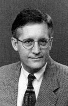
Submitted by Ed Danson, United Kingdom. Note: By request, Ed, a land and geodetic surveyor in England, sent the above article for the Harlan Web site. He recently completed a book about the exploits of Charles Mason and Jeremiah Dixon, and in it he gives an account of their close association with John Harlan, #68, of the Stargazer House located in Embreeville, PA. The title of Ed's book is "Drawing the Line: how Mason and Dixon surveyed the most famous border in America". Publisher: John Wiley & Sons, Inc., New York. ISBN 0-471-38502-6. Price ticket is $24.95. It is available on Amazon.com

